Peterborough back to Trenton

I always feel some regret when any part of a trip ends. It was sad to leave the North Channel and the Georgian Bay because I’m not sure we will ever get back there. Of course, it was very sad to see Kelly’s family leave because I love spending time with them and I miss those hugs and kisses and the funny things that can only come from children. Today we left the Trent-Severn Canal for the last time and I felt another pull on my heart that this section of our adventure is complete. There is so much left to do and so many places left to explore, but I can’t help being sorry to see this part end.
IMG_8412 IMG_8422 IMG_8424 IMG_8426

IMG_8407

We left Peterborough on Tuesday morning and headed to Hastings, a very small town where we stopped on the way north. Back in the locks again, this time we had only drops to make. Lowering through the locks is much easier than lifting. When we enter to be lowered, the lockmasters take our lines and wrap them around the cable and hand the end back. I can tie my line to the boat and, as long as I am monitoring what is going on, I can pretty much take it easy as we are lowered. John usually holds onto his line because he is in between two cleats, but I have the stern set up so it’s really easy.

IMG_8349 big chute-12 IMG_8436

Wednesday we traveled to a very nice park near Lock 8. The park there is very rural and quiet and we took advantage of not being in any rush the next morning. John worked on the generator, which needed a little maintenance and I enjoyed some time to read and relax. After a picnic lunch we motored for about two hours to Lock 6 in Frankford and spent the night there. It was a full moon last night and I took advantage of the clear sky to get a little photography done. Just before we went to bed, John noticed the little clouds that had developed and the way the moon lit them up. I had to get a few more shots, of course!

Today we re-entered Trenton, where our journey on the Trent-Severn Canal began over a month ago. When we were here last, many people in town talked about the new marina that would be opening soon. It is a town marina and the old one where we stayed last is now closed. The new marina is really beautiful. Although the pictures below were all taken with my iPhone, I wanted to post them for our boating friends who will appreciate the luxury here compared to that of others. I know that some of you have stayed in the town marina before and I thought you might like to see the new building, too.

IMG_1173  big chute-2big chute-3

Beautiful private bathrooms

big chute-7big chute-6

FREE laundry including detergent

big chute-5 big chute-4

A beautiful lounge with a fireplace right near the laundry.

big chute-8

The new building.

IMG_8448 IMG_8444 IMG_8440

IMG_8436

Tonight a storm started moving in and the sky changed colors and looks continuously. A rainbow even appeared for a little while.

Now we are preparing for our next set of visitors. Our friend Alex is meeting us in Kingston on Monday along with his two grandchildren, Sasha and Harris. We will traverse the Rideau Canal from south to north from Kingston to Ottawa and then, after they leave, Chris and Sam will join us for the return trip. At the end of August Ned and Anne will come along wherever we are! We are so happy we can share the fun with our friends!

Here are the maps that show where in the world we are today.

big chute-11 big chute

Orillia to Peterborough with the kids and grandkids

Strangely, this will be a rather short post. Traveling with kids and grandkids is busy, fun, and exciting! Although you might think we would take more pictures, the activity limited the photography a bit, but we have some photos that show the excitement of being together on the water.

big chute-12 big chute-13

Michaela learns to tie boat knots.

big chute-14 big chute-15 big chute-16 big chute-17

Cheating a little on the fishing!

big chute-19

Kirby found a new place to relax that he had never discovered before – the Pilot house berth.

big chute-20

I came upstairs one morning to find these two comfortable as could be.

big chute-21

Michaela was great at tending the locks.

big chute-22 big chute-23

A dragonfly landed on Michaela’s hand!

big chute-24

One day I walked in and found Carter at the wheel without Bop anywhere in sight!

big chute-25

Picnicing on land.

big chute-26

Best of Friends?

big chute-31

Maybe, but Madison had cheese and Kirby loves cheese!!

big chute-27

My bow of the boat buddy.

big chute-28 big chute-29

On the Peterborough Lift Lock – Kelly and Michaela

big chute-30

Sadly, time for the kids to return home.

We met Kelly, Craig and family in Orillia Monday evening. They drove from Jacksonville, FL to Niagara Falls, NY between Sunday and Monday and they stopped and did the things you must do at Niagara Falls: the Maid of the Mist and the Cave of the Winds. Then they drove the 3 remaining hours to meet up with us at the Port of Orillia.

John and I had decided to spend Tuesday in the marina so everyone could become accustomed to AfterMath and the little ones could spend the day enjoying the town of Orillia. There is a great playground and beach in Orillia and both are adjacent to the marina.   John and Craig went off to rent a car and bring Kelly and Craig’s van to our final destination while they were aboard, which was Peterborough. It was Kelly’s birthday, so the ladies of the group were off duty for driving and we really enjoyed the park and the 95 year-old ice cream stand with the little ones.

Over the next few days the kids were able to swim, go for dinghy rides, drive AfterMath and the dinghy, eat lots of ice cream and have a great time overall. Michaela carried on the family tradition of learning boat knots, we stayed on lock walls and fished (Kelly caught a few sunnys, but I still haven’t caught an edible fish), we ate picnic lunches and pizza dinners on shore, went to a concert in town, swam, played on playgrounds and just had a wonderful time. We stopped in the little towns of Fenelon Falls, Bobcageon, and Lakefield along the way. It was sad to see the Kirk family leave today. We can’t wait to see them again in Jacksonville and to have them ride with us again!

Traveling South (Killarney – Covered Portage Cove – Bustard Islands – Hopewell Bay near Pointe Au Baril – Killcoursie – Indian Harbor – Frying Pan Bay – Big Chute – Lock 42 – Orillia)

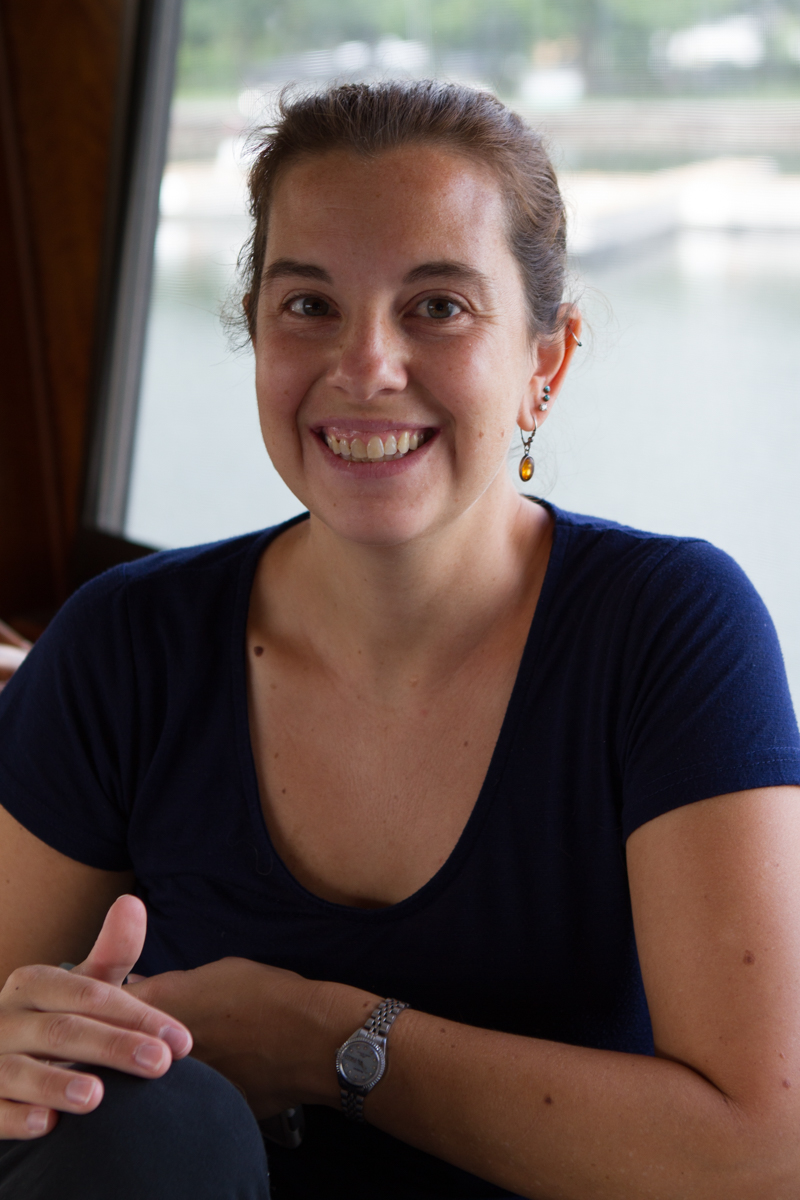
Note: We realize that our posts have been delayed, but we have not had any Wi-Fi service since we left Killarney on the morning of July 9th. We truly were in the wilderness much of the last couple of weeks, but we are now re-entering civilization and should be able to post more frequently.
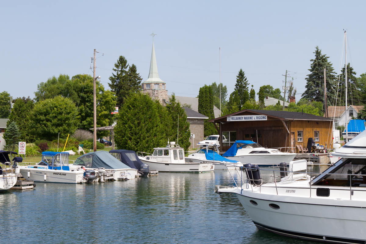
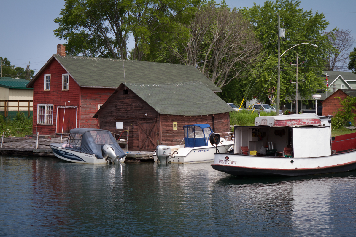
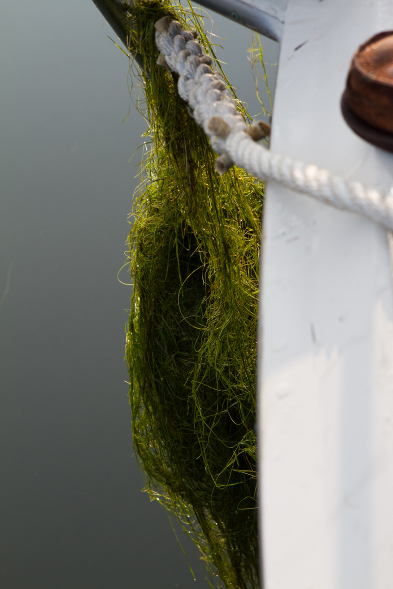
killarney to covered portage-2killarney to covered portage-3

killarney to covered portage

Killarney

killarney to covered portage-10

Killarney even has a drive in theater for boats!

killarney to covered portage-4 killarney to covered portage-5 killarney to covered portage-7 killarney to covered portage-8 killarney to covered portage-9 killcoursie to Indian Harbor-2

Covered Portage Cove

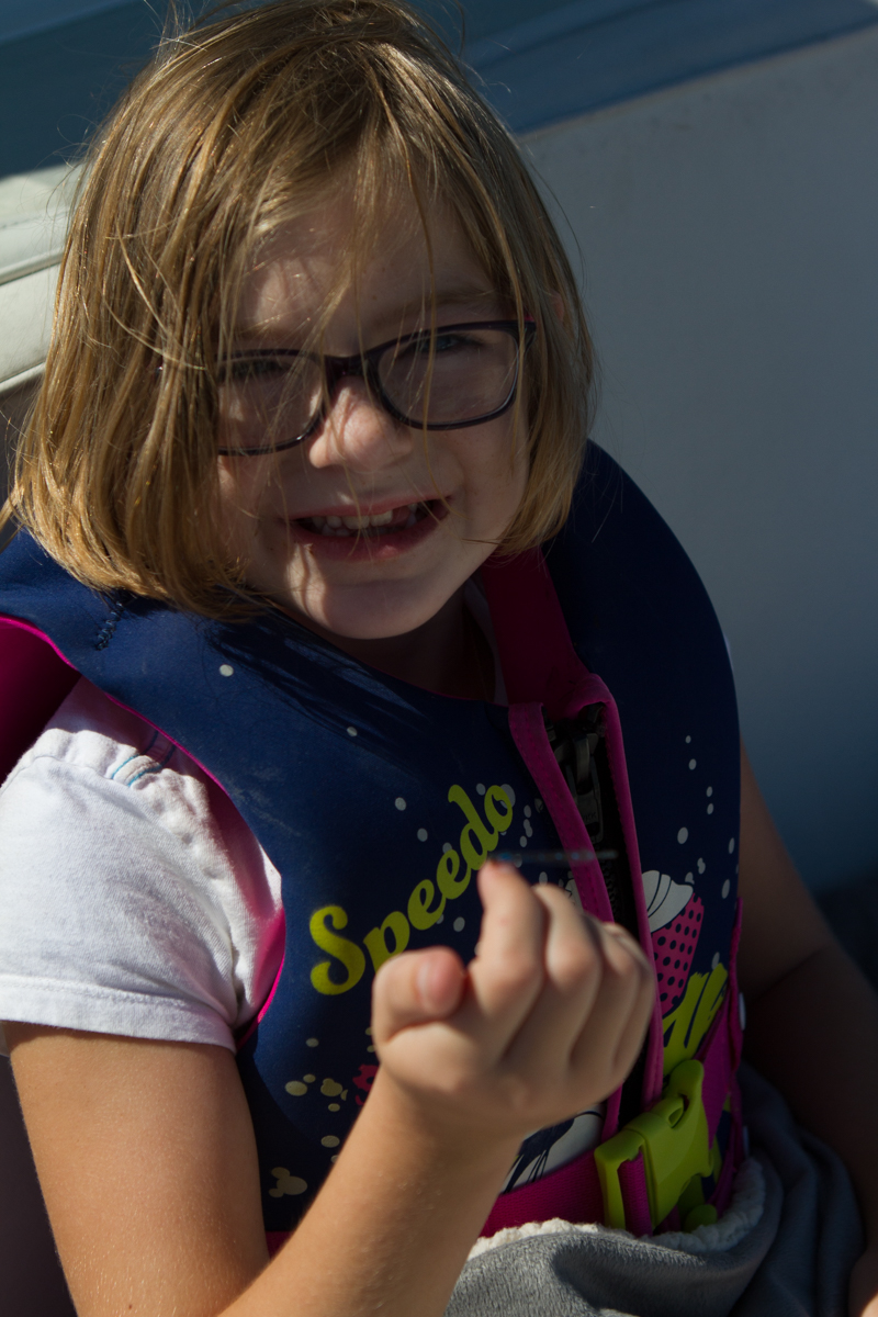
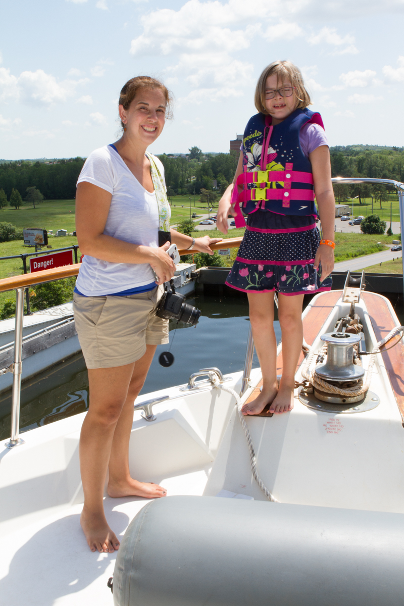
It was hard to leave Killarney, the gateway to the North Channel. The Killarney Mountain Lodge marina there was beautiful with its manicured lawns, beautiful flowers, brand new docks, and inviting red Adirondack chairs where one could sit and watch the boats go by. Before we untied I took a quick walk to the local fish market to buy fresh fish for dinner. Then off we went to Covered Portage Cove, a lovely anchorage near Killarney, where we took a dinghy ride and stayed for the night.

The next day, Friday, we took one last ride through Killarney on our way back to the beautiful anchorage in the Bustard Islands where we had stopped on our way north. It was a longer day of motoring and we were back out on the open bay, but the payoff was that after that day most of our travels would be in the small boat channel on Georgian Bay.

bustard islands to anchorage near point au baril bustard islands to anchorage near point au baril-11 bustard islands to anchorage near point au baril-10 bustard islands to anchorage near point au baril-8 bustard islands to anchorage near point au baril-7
bustard islands to anchorage near point au baril-2

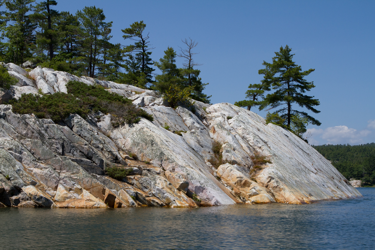
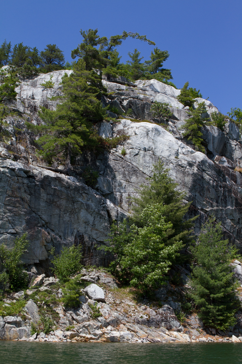
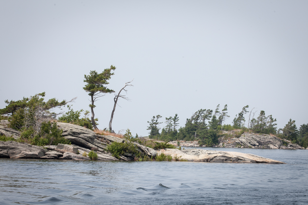
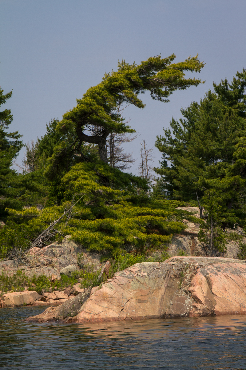
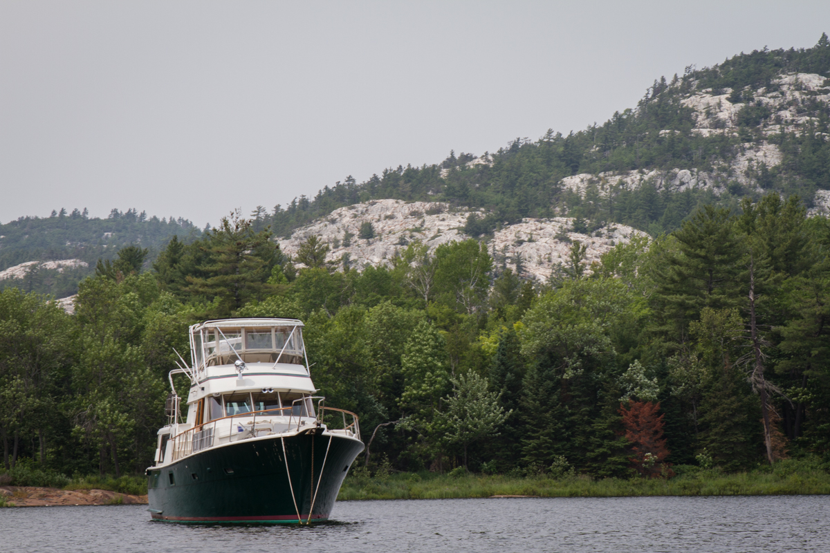
The Small Boat Channel

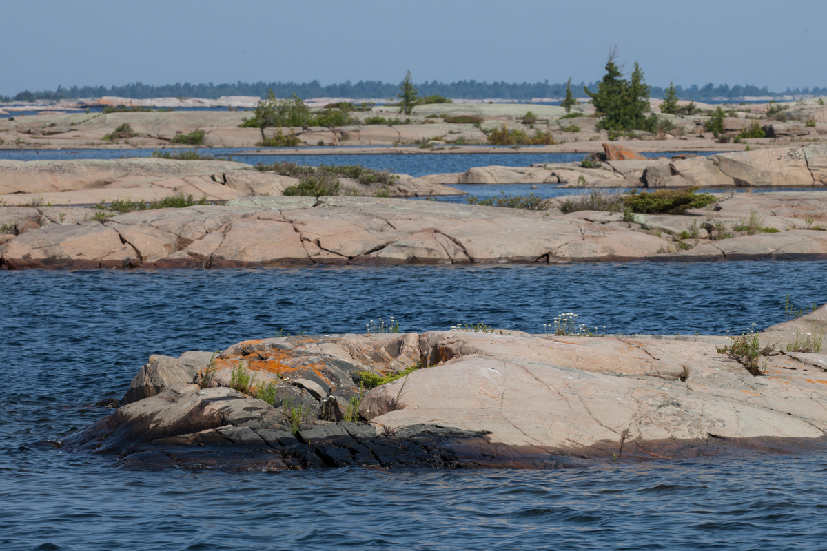
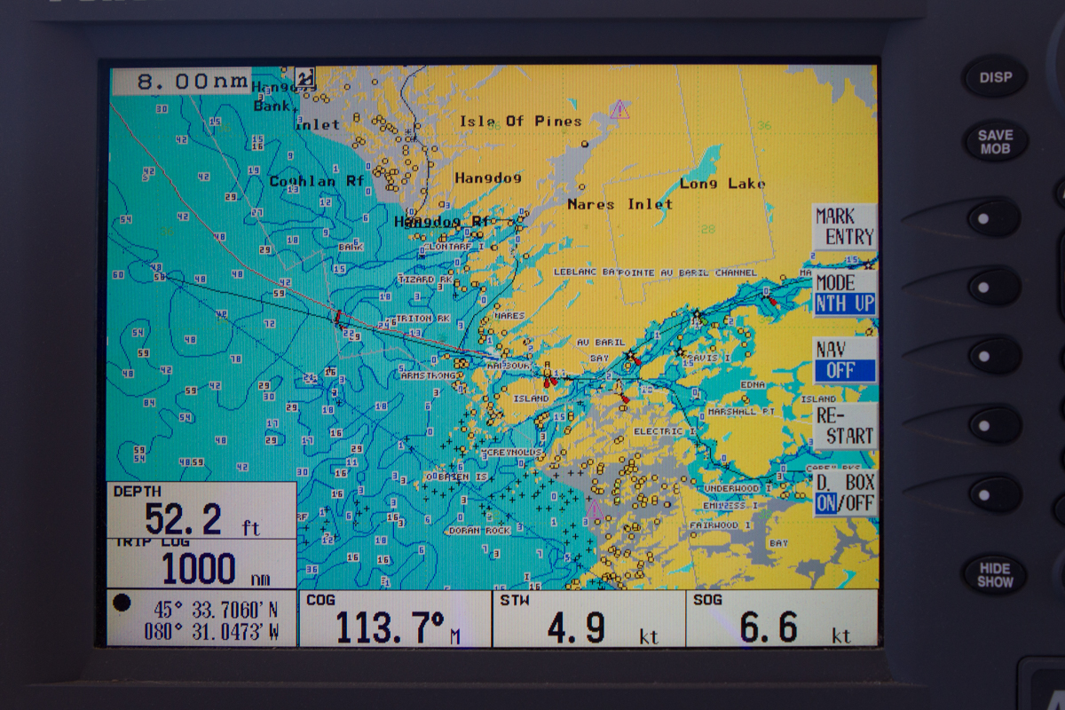
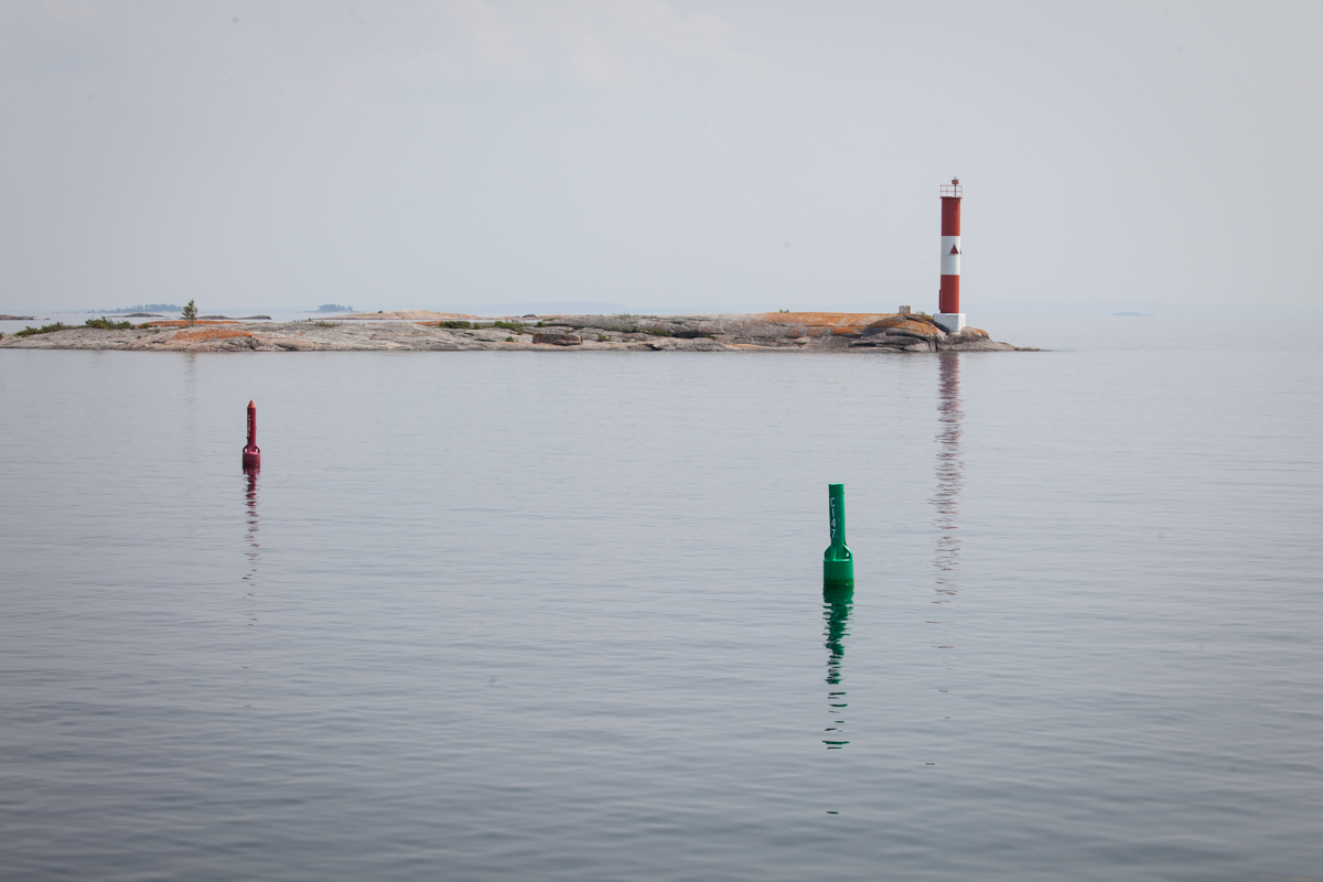
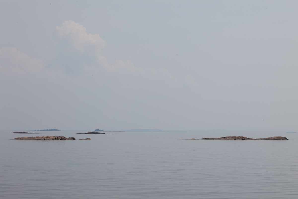
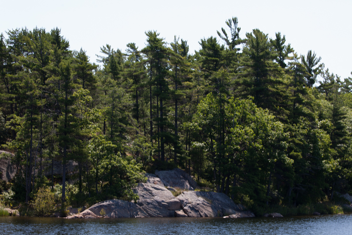
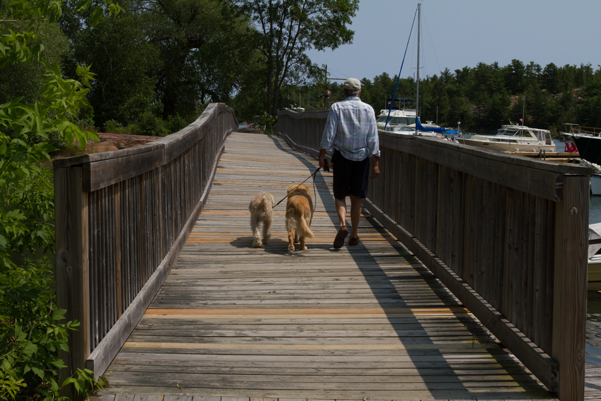
The small boat channel is fascinating. It is a challenge for the helmsman (John), but a joy for the photographer (me)! For much of the trip on Saturday the seascape was dreamlike. If you can imagine the surface of the moon covered with water, but with rocks and craters sticking out in a random pattern with just a little vegetation, you will have an idea of the scene. Besides photographing the channel, I sat far up on the bow to watch for boulders that may not have been charted. John did an amazing job of weaving his way through, sometimes with barely enough room for AfterMath to make the turn between the closely placed red and green buoys that guide the way. Because there are so many intersecting channels on the bay, to make matters worse, it is sometimes hard to remember which side the red or green should be on as it’s difficult to tell if you are returning to or leaving the larger body of water. (Generally, the saying is, “red right returning”, but you have to know if you are coming or going to make that work.) In our case it changed several times a day!

bustard islands to anchorage near point au baril-4

bustard islands to anchorage near point au baril-5 bustard islands to anchorage near point au baril-6

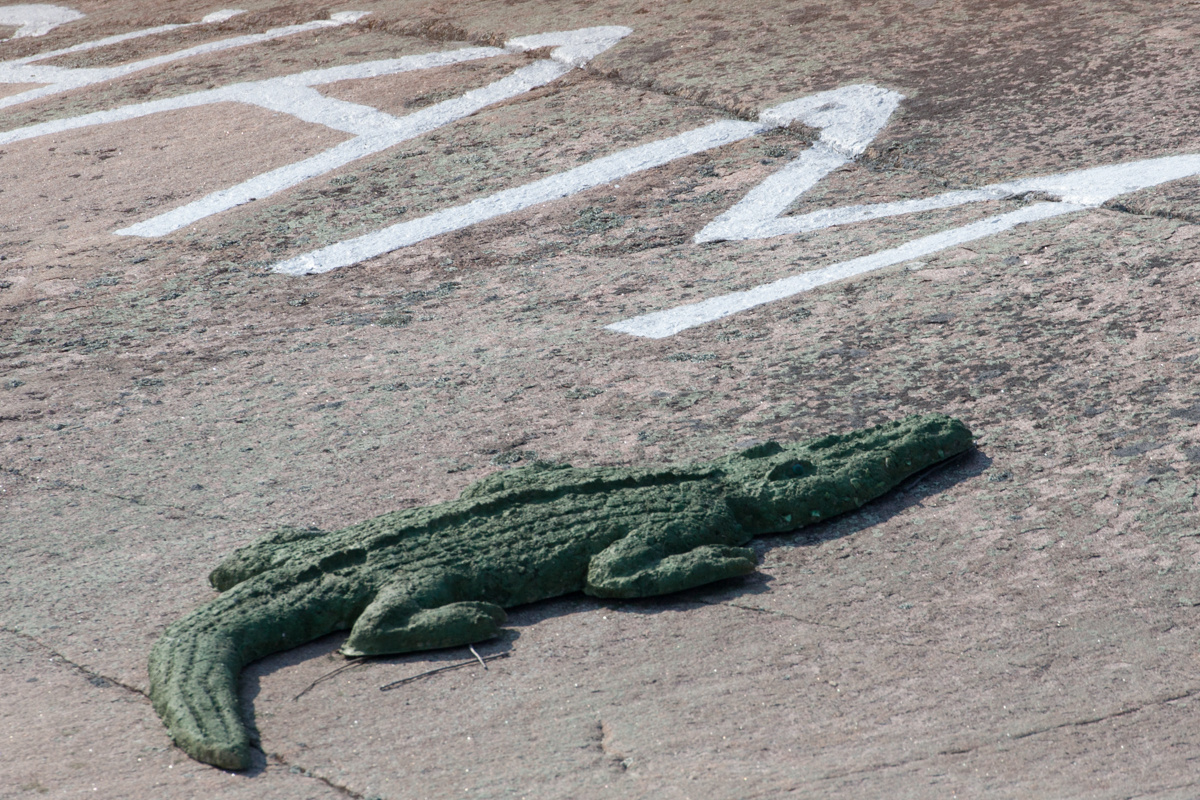
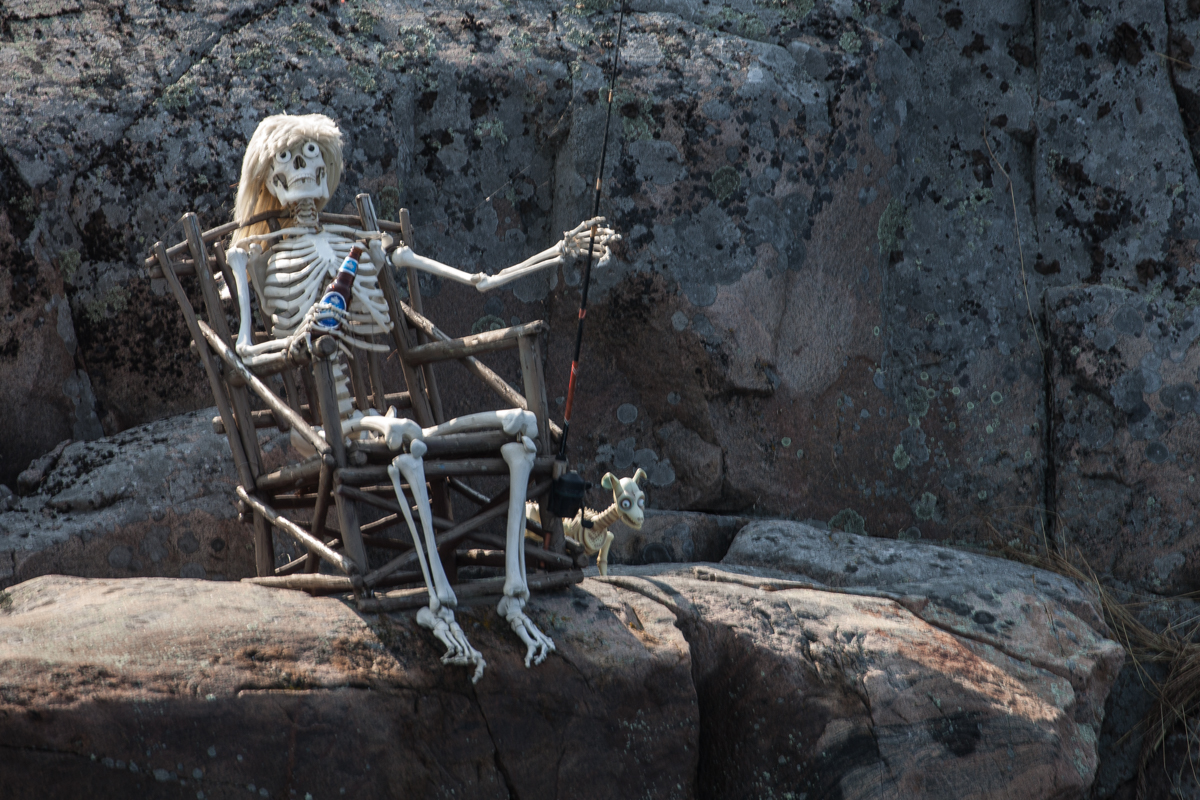
Snakelike in curves, one of the especially tricky areas was next to an island that is apparently owned by the Cunninghams. At first I just noticed the big letters painted on the rock, but soon we discovered that the Cunninghams have a sense of humor! It is possible that the only alligator in the Georgian Bay exists on their land, and the blonde fishing skeleton with her dog reminded me that it may take a long time for me to ever catch a fish larger than the one 5 inch one I caught a while ago!

bustard islands to anchorage near point au baril-13 bustard islands to anchorage near point au baril-14

sunset at bustard islands

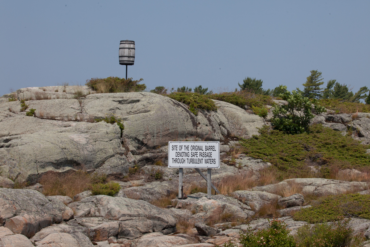
After piloting through the rocks, we had to detour out into the bay again, as one part of the channel has turns that are too short for any boat over 40 feet. The detour brought us back past a lighthouse we passed days ago and past landmarks we have seen before. Apparently, Pointe au Baril is named for the barrel shown here. It marked a treacherous point where a canoe was once lost. The story says that a barrel of whiskey was found the next spring that had fallen from the canoe. Fur traders drank the whiskey and then left the barrel as a beacon to mark the dangerous area. Eventually a torch was placed there for the first returning fishermen to light each day to guide the other boats. The cross is a monument to Samuel Champlain who first came to the Georgian Bay in 1615. He was the first European to map and explore the bay, which was named for King George IV in 1822.

bustard islands to anchorage near point au baril-15

While making our passage on Saturday we passed a milestone for us! We could now proudly state that we had traveled 1000 miles since the beginning of our voyage and we did it without any mechanical delays or groundings! I still knock on wood every time I even think this thought.

bustard islands to anchorage near point au baril-3

loon

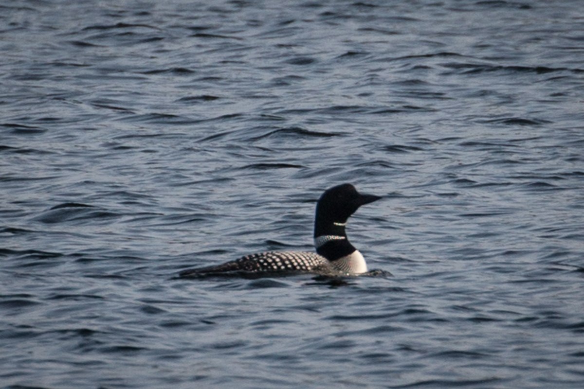
At the end of the day we anchored in Hopewell Bay feeling successful and happy. There we met a loon who calmly approached the boat until Kirby decided to greet it with a few too many friendly barks. Those of you who live where loons reside will probably agree that they are beautiful birds with a haunting call that is easy to identify and long remembered. I was happy I snapped a shot of our friend before he ducked underwater and swam away from the cheerful Wheaten Terrier who only wanted to play.

point ay baril to killcoursie

Sunday took us a short distance to Killcoursie. There we anchored in a Killdeer Provincial Park. It was a bit of a change from our normally calm and quiet havens, but it was fun for a day. There were campers lining the shores and beaches with the noise of summer everywhere. Jet skis and water skiers zoomed around, but thankfully, were not allowed in the anchorage or the swimming areas. We hopped in the dinghy for a ride to a nearby marina to look for a casting rod for me (It must be the rod that is the issue, not the fisherwoman!) and we passed a wedding taking place on the rocks with the bride and groom standing on a rock out in the water. Unfortunately, I didn’t bring my camera so that event will go undocumented, and the marina didn’t sell rods, so it was an unsuccessful adventure.

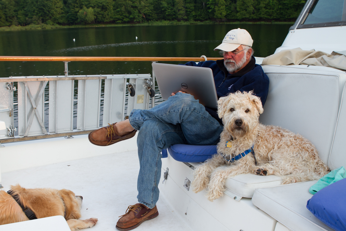
During the early morning Kirby proved to us what a great watchdog he is. Along the way he has been alerting us to boats if he thinks they are too close and he has been very helpful at times, but Monday morning while we were all sleeping, we heard him run full speed up the stairs from our room and bark wildly. We couldn’t imagine what the fuss was about, but he was so adamant that John got up to check it out. What Kirby heard from down below was someone from a neighboring boat who was swimming parallel to AfterMath, but only about 15 feet from her. Apparently that is in our personal space, according to Kirby and he was alerting us to the terrible danger! While there was really no threat, of course, it was nice to know that no Pirate of the Caribbean will be coming onboard quietly. Of course, if any pirate makes his way aboard, he will be greeted with Wheaten kisses and requests for pats and cuddles along with the Golden Retriever imitation of a throw rug. Watchdogs, maybe. Guard dogs, not at all.

killcoursie to Indian Harbor-5

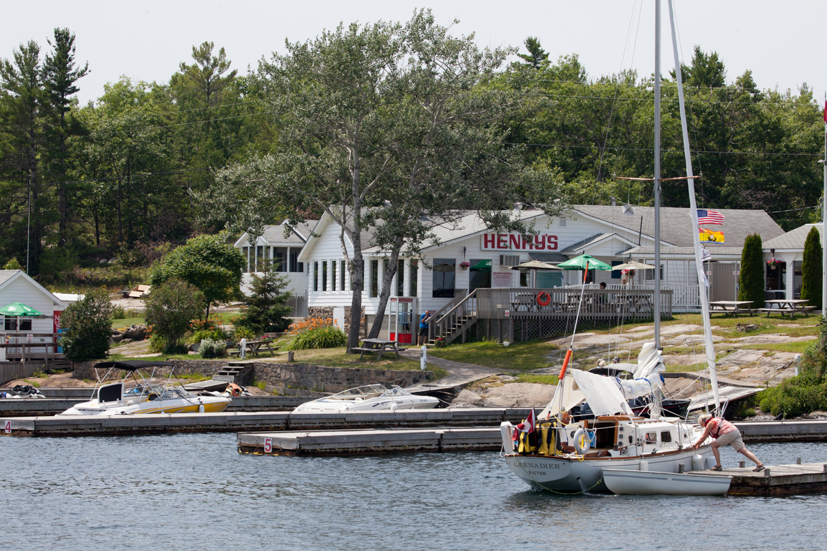
On Monday we made our way again through the channel of rocks and obstacles to Indian Harbor with a stop at Henry’s Fish House. Henry’s is famous for its fish and chips and is a destination for most boaters on the bay. The meal was delicious, and, almost not surprisingly anymore, we met a couple that spends quite a lot of time with friends in Bradenton, Florida. They were so excited to talk to us that we would never have told them what a common occurrence this is.

killcoursie to Indian Harbor-9

killcoursie to Indian Harbor-10

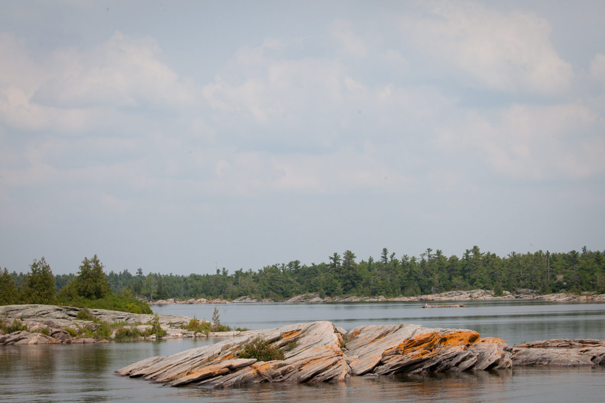
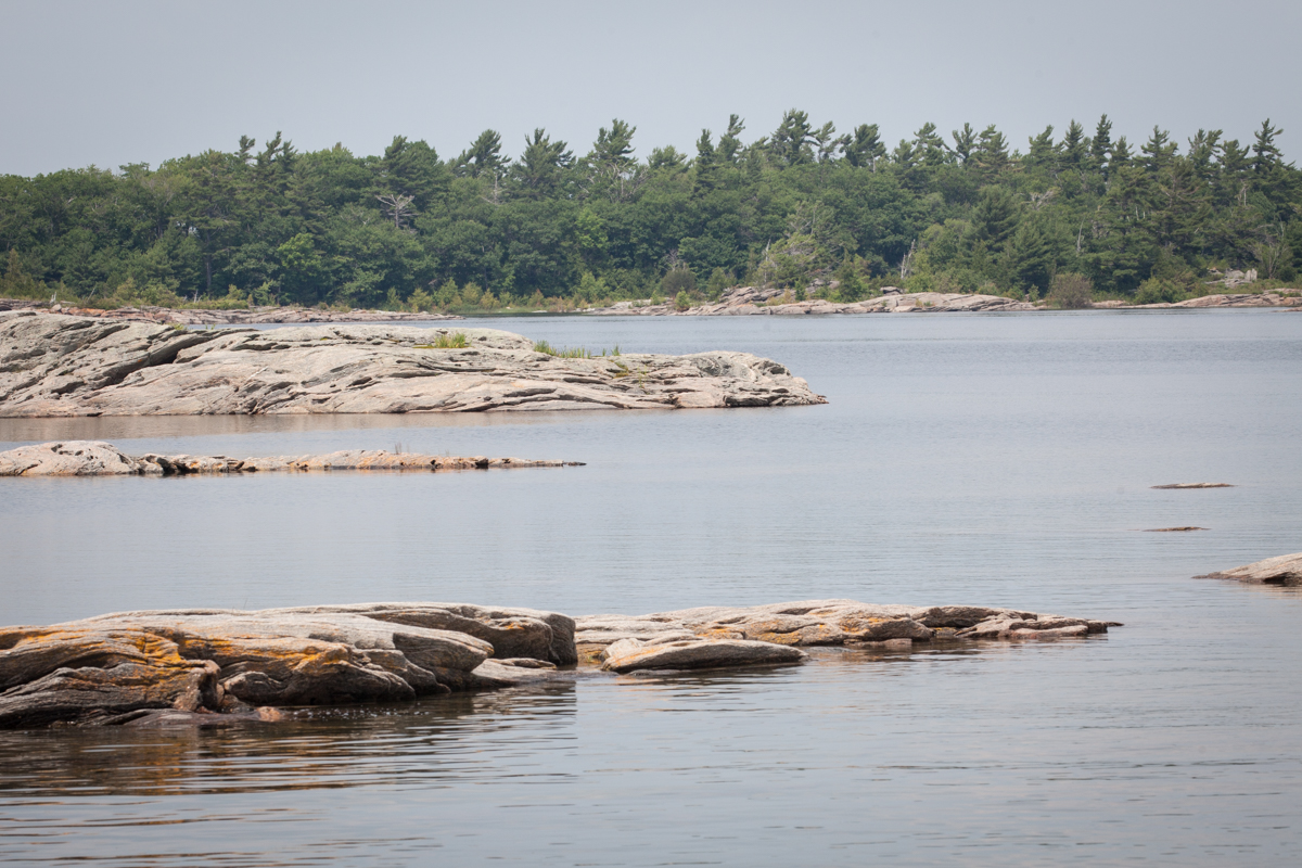
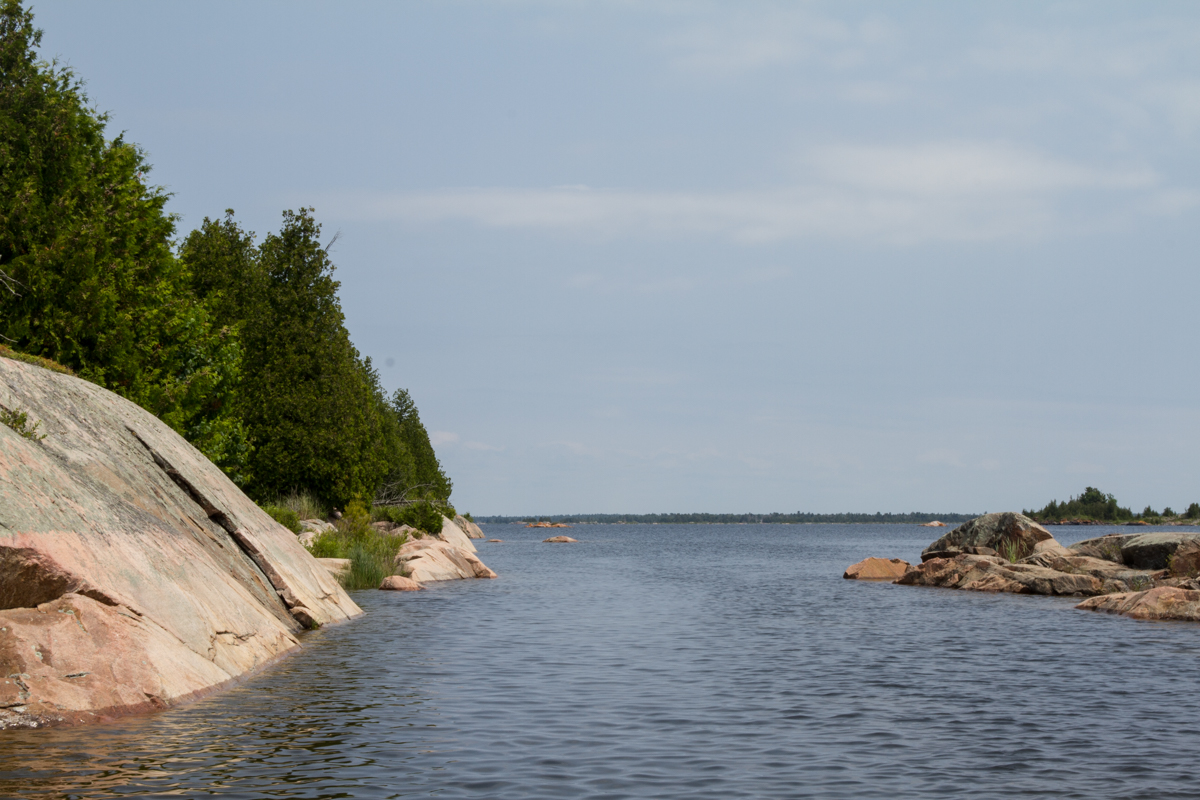
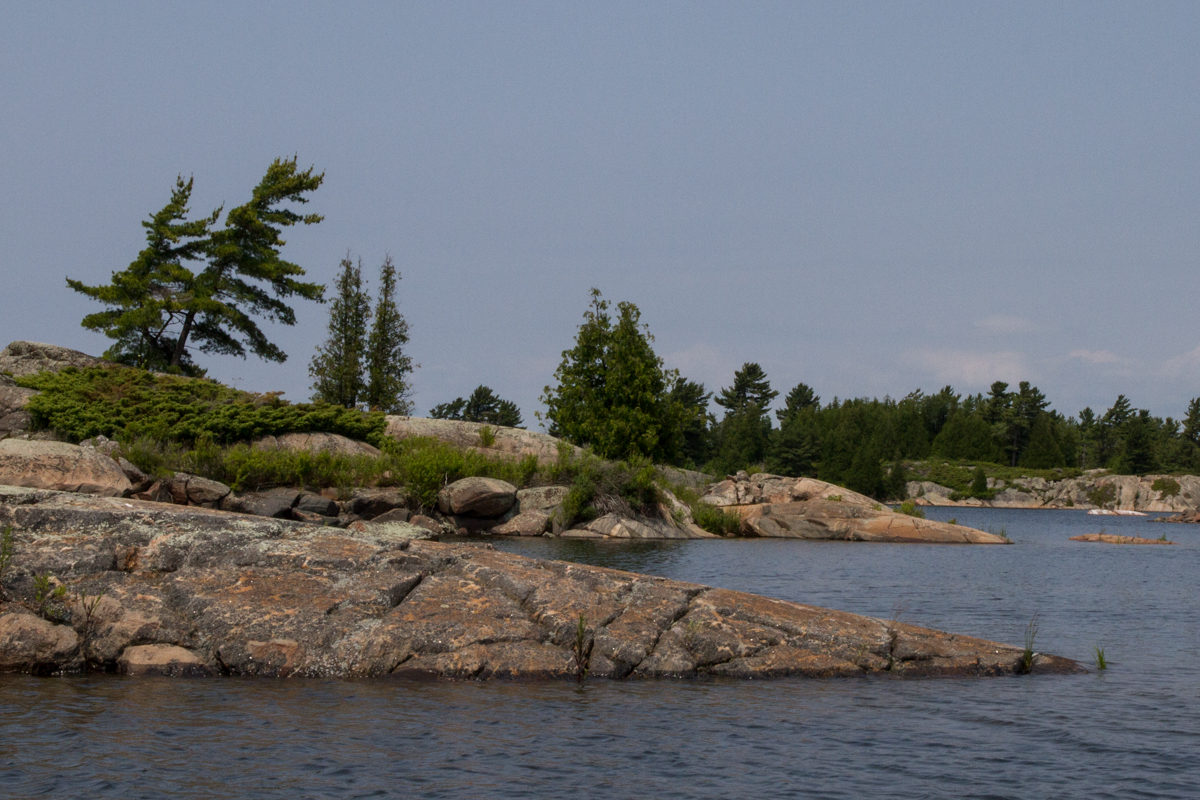
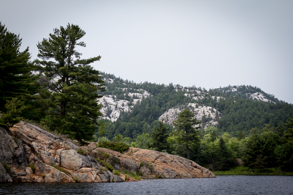
The rocks are so beautiful and varied in color

killcoursie to Indian Harbor-8 killcoursie to Indian Harbor-7 killcoursie to Indian Harbor-6

killcoursie to Indian Harbor-12
killcoursie to Indian Harbor-13  

killcoursie to Indian Harbor-11

killcoursie to Indian Harbor-14

killcoursie to Indian Harbor-15

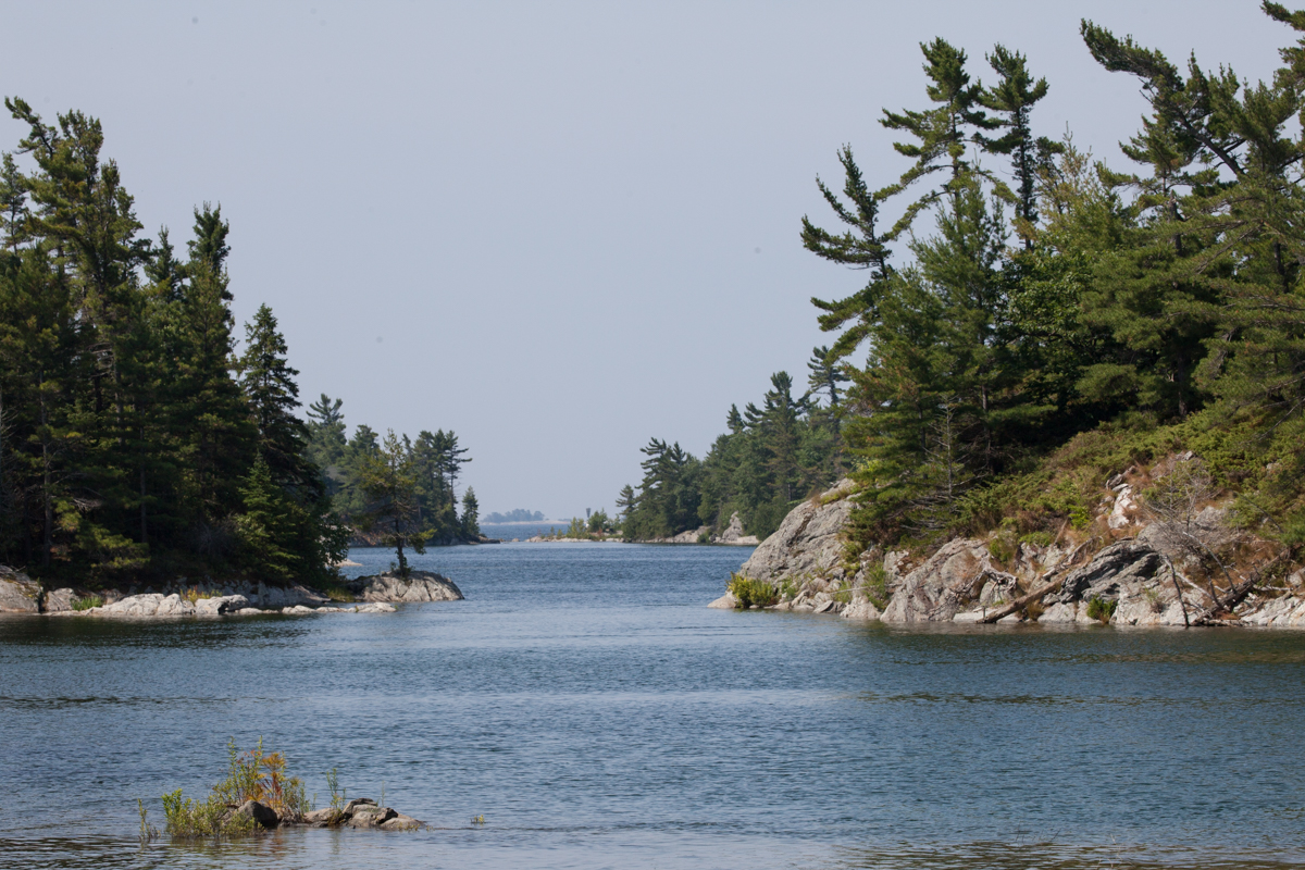
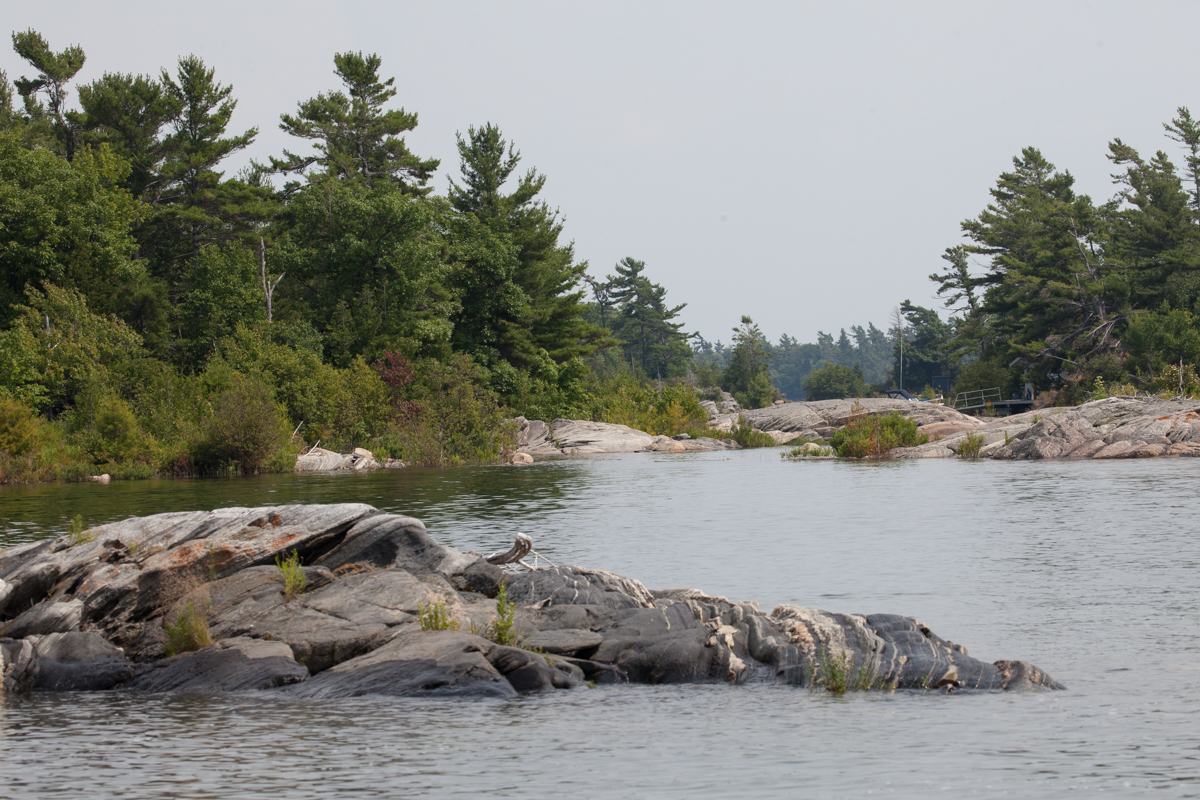
Back through the rocks and complicated channels

killcoursie to Indian Harbor-21 killcoursie to Indian Harbor-20
killcoursie to Indian Harbor-17 killcoursie to Indian Harbor-16

killcoursie to Indian Harbor-18

Dumbo has nothing on Jake when he is on a dinghy ride!

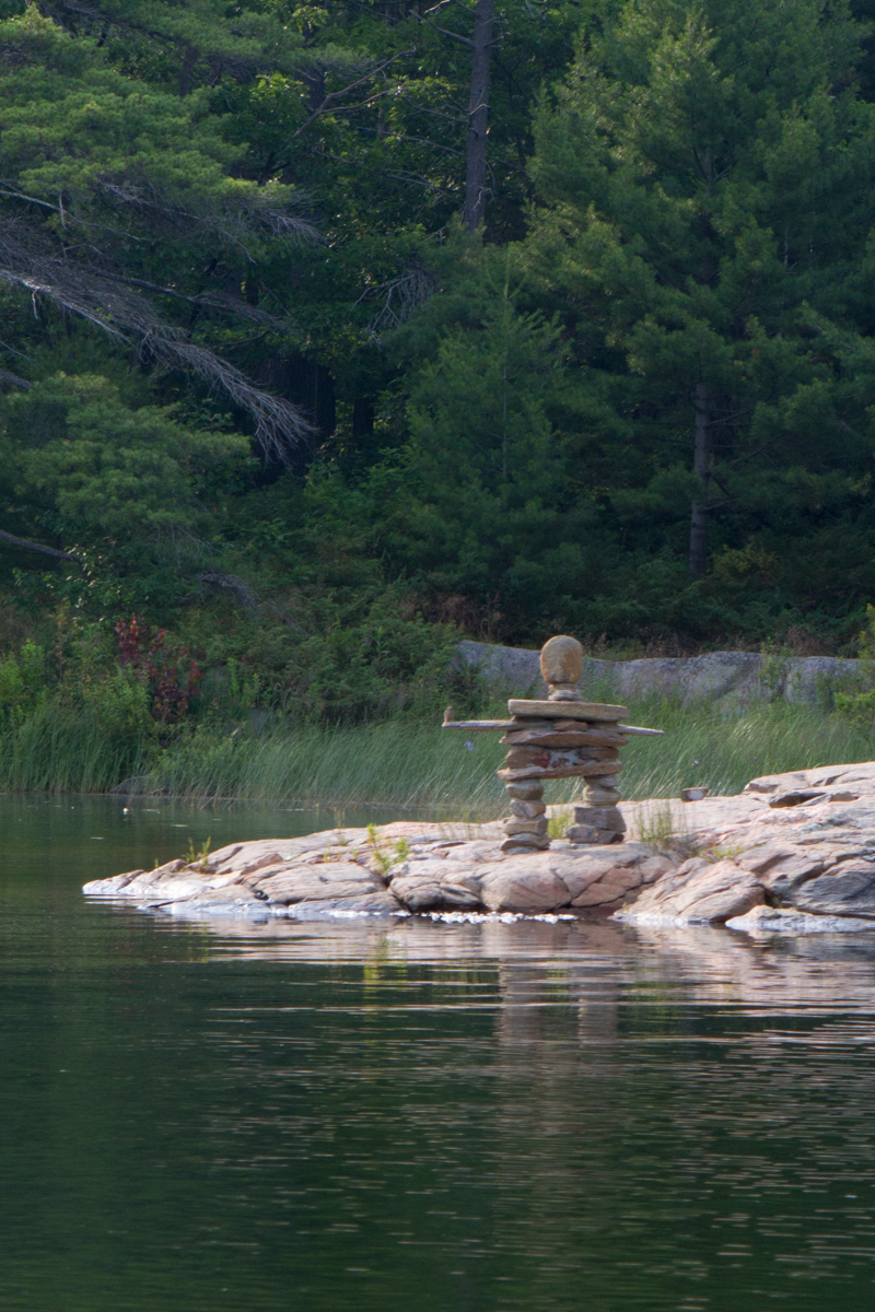
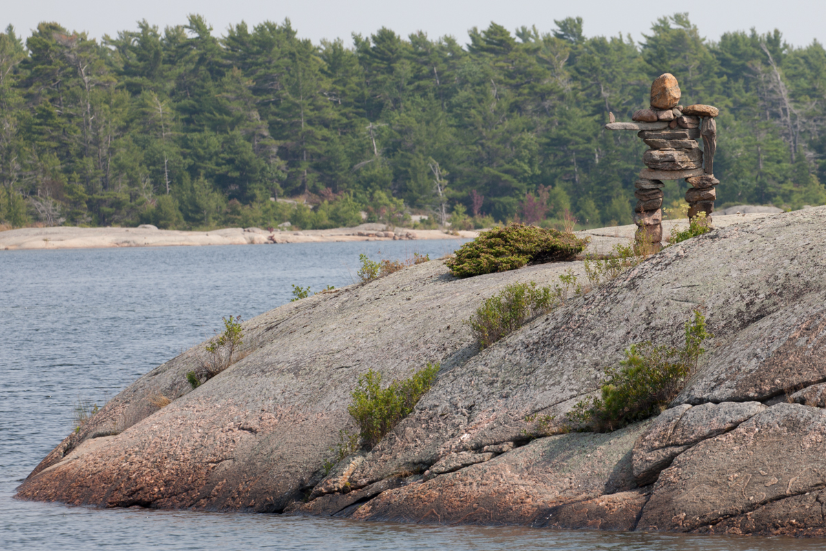
We arrived in Indian Harbor and were greeted by a large Indian made of stone at the entrance. It was a fun way to start our adventure in this little stone-surrounded cove. We anchored and put the dinghy in the water right away and then took off to do some exploration. Along the way we discovered lots of stone Indians. It was almost a treasure hunt to look for them.

While we can say that AfterMath has never hit a rock, we can’t say the same for the dinghy! The little inlets here can have depths of 25 feet one second and just a few feet farther have just a few inches. While the water is clear and it is easy to see down at least 8 feet to the bottom, one look up at the scenery is enough to make a person miss the next boulder under the surface. We never hit very hard, but we are quite happy we had a keel guard put on when we ordered the little boat!

It was such a beautiful anchorage and we needed a day to catch up on cleaning and tasks, so we decided to stay another night. Also, we knew a storm was going to pass through and we were safe and secure where we were. Unfortunately, we didn’t get back out on the dinghy, but I think both of us looked at that as a mixed blessing.


indian harbor to frying pan bay-2

indian harbor to frying pan bay-4

Traveling from Indian Harbor

indian harbor to frying pan bay

Another momunent for Champlain

indian harbor to frying pan bay-3

Frying Pan Bay

Wednesday brought us to Beausoleil Island, a Canadian National Park, where we entered Frying Pan Bay. It’s a very small anchorage, but a popular one. There are a couple of docks for a few boats, space for a few boats to anchor, and some space along the shore for those that both anchor and tie up to a tree with a stern line. We got AfterMath settled and had a relaxing afternoon and evening there.

After a lazy morning in our anchorage, pausing for extra coffee outside in the warm sunshine, it was time to raise the anchor and be on our way. Leaving Frying Pan Bay was bittersweet as it meant we had reached the end of our trip on the Georgian Bay. We enjoyed our time there so much, but we have a date to meet Kelly and her family in Orillia on July 20th and we are so excited to see the kids and grandkids. It’s hard to believe it’s been almost four months since we have seen them as, in the past, we were together every few weeks. Thursday, though, was a gorgeous day and we fully enjoyed slowly winding our way through the narrow channels of rocks for the last time.

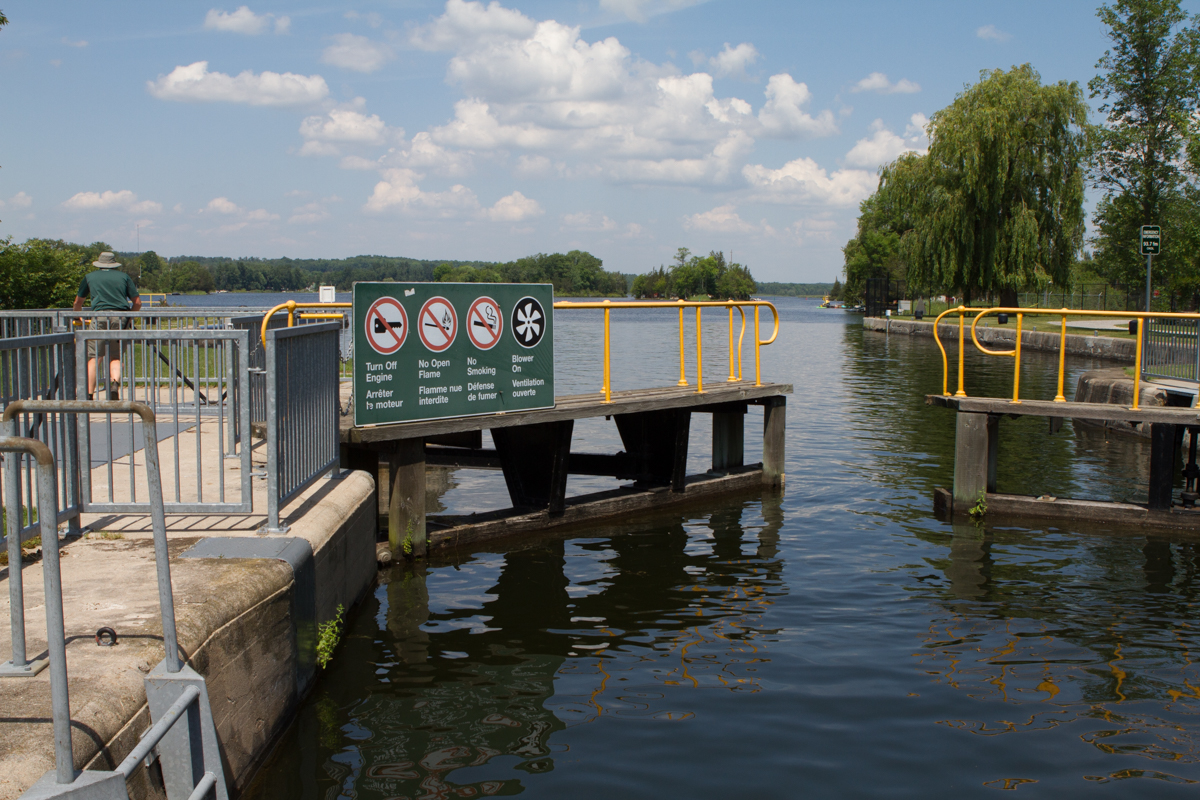
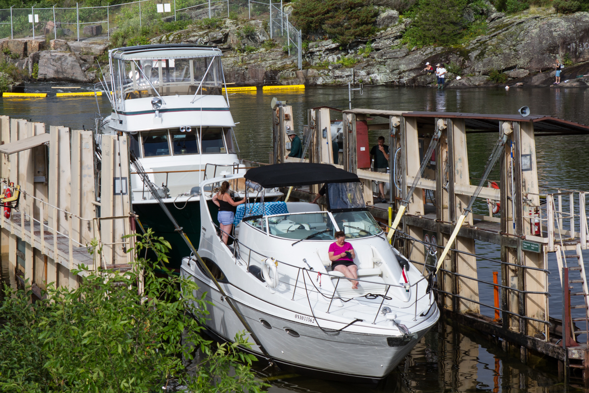
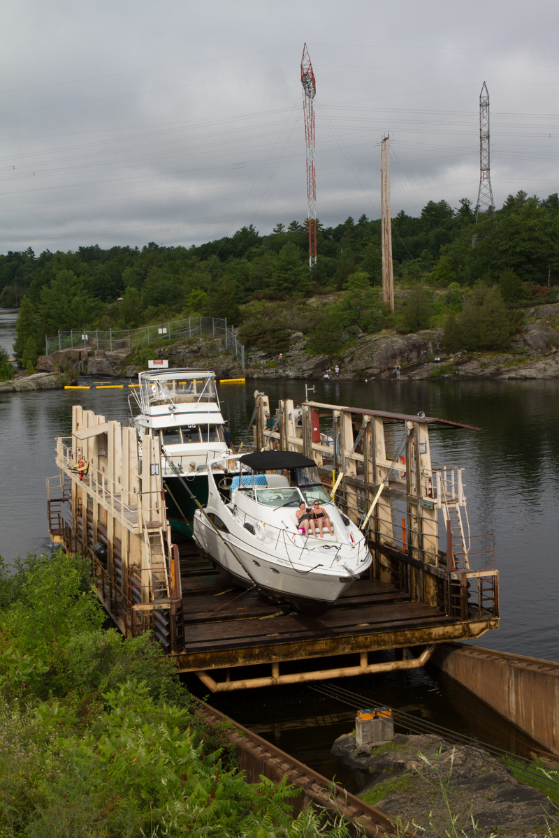
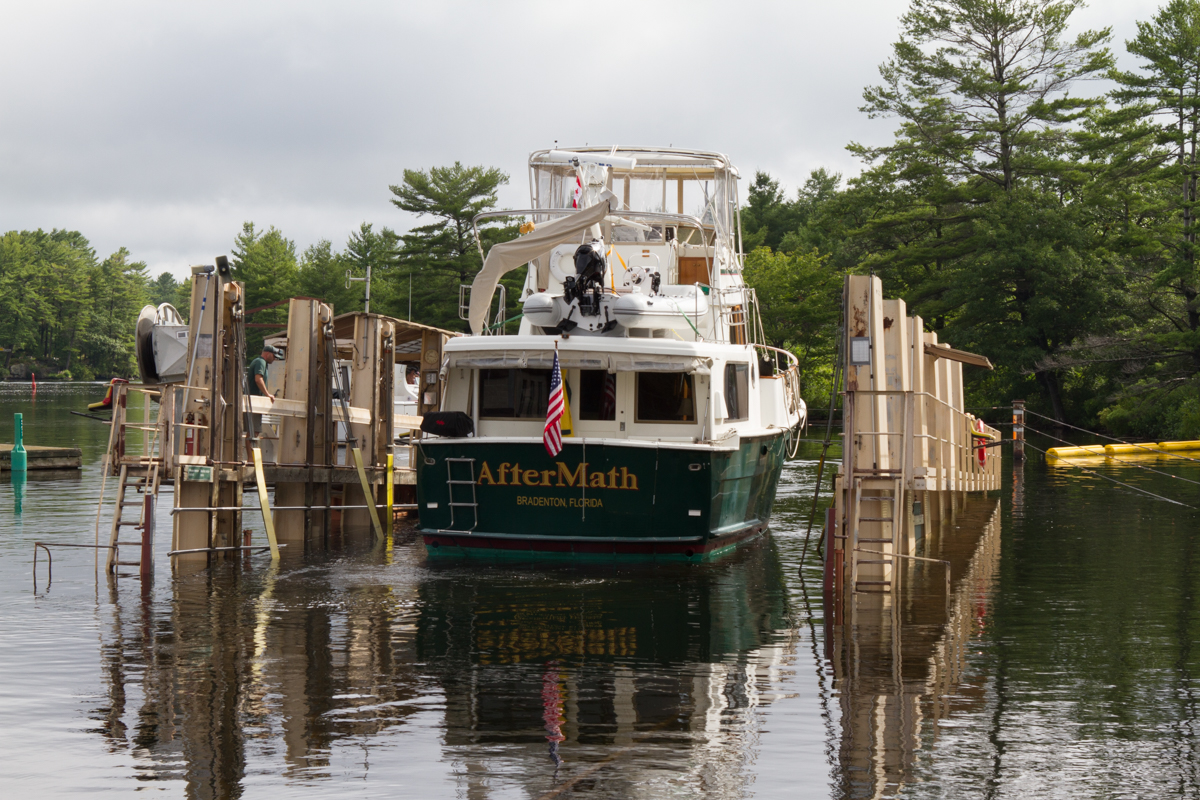
Before we knew it, we had traveled back into the Trent-Severn Canal and once again traversed the first of our southbound locks. We made our way back to the docks at the bottom of the Big Chute, but, as it was late afternoon, we decided to take advantage of the safe harbor there instead of continuing over it. We were surprised by a rainy day on Friday. John had built in a couple of rain days and it’s not fun to do locks in the rain, so we stayed put on the dock and took care of a few jobs such as defrosting the refrigerator and neatening up Kirby’s hair a little bit.

big chute

big chute-2 big chute-3 big chute-4 big chute-5 big chute-6

big chute-9
big chute-10

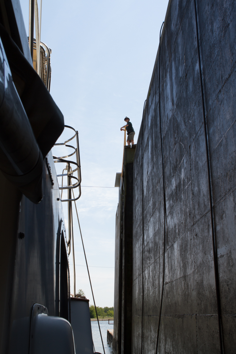
At every lock on the Trent-Severn, there is what is called a “blue line” on the wall. Boats tied up along the blue line are ready to go through the lock and are awaiting a signal from the lockmaster that it is safe to enter. Most of the time a green light appears, but at the Big Chute and the two pan locks at Kirkland and Peterborough boats are called in individually. We moved AfterMath to the blue line at the Big Chute early yesterday, Saturday, in preparation for her transport again over the hill and the road and then back into the water on the other side. This time I wanted to get pictures of AfterMath in the system, so I hopped off when we were called and went up the stairs next to the railway. It was great fun to see how it all looked from shore and, even though I really enjoyed staying on the boat when we were traveling north, I am happy to have the pictures I took on the southbound leg. John picked me up on the other side and we headed on through a couple more locks before stopping for the night.

Today we are in Orillia. We are so excited that we will be meeting up with the Kirk branch of the family tomorrow. They are stopping at Niagara Falls on their way here but they will be here late in the day and in time to celebrate Kelly’s birthday, which is Tuesday. There is a large park near the marina in Orillia with a beach, a playground, gardens, and a splash park for the kids. We will stay here tomorrow and Tuesday nights and then go on our way with everyone aboard. This quiet boat is about to come to life and we can’t wait!!

frying pan bay back to big chute frying pan bay back to big chute-2


The Georgian Bay and the North Channel (Midland – Gowar Bay – Bustard Islands – Heywood Island -Baie Fine – Killarney) Goals accomplished and a little unwanted excitement!

The Georgian Bay and the North Channel. Those words mean a lot to John and me. This is the area, on the east side of Lake Huron, of which we have read so much. Every single person we have spoken with who has been on these waterways has told us about the beauty here. Also, every single person we have spoken with has told us that the channels can be dangerous as they are rocky and shallow in so many places. The guidebooks all warn that in the length of a boat the depth can change from 100 feet to just a few inches. There are marinas in the area that derive most of their business in fixing bottoms and replacing propellers and shafts on boats damaged on the rocky ledges. There is a small boat channel and a shipping channel farther out in the Georgian Bay that freighters use. Even in the freighter channel, depths can change quickly. Charts MUST be followed and, in many places, it is a good idea to have one person on the bow looking for rocks under the water. Boaters in the small boat channel must make their way slowly. But, all that being said, these two waterways were our goals and we wouldn’t miss them.

IMG_7827

Midland

Last Wednesday, while John was working with a service tech on getting the oil in changed in Midland, I decided to provision again as we were making preparations to head to some very remote places where no supplies could be found. I went to the marina office to ask how to get to a grocery store and was offered a ride by a man who works in the marina. This worked out great. He took me to the store, waited while I shopped and then drove me back with all of my groceries.

Cowar Bay moon rise (Thursday)

Moonlight at Gowar Bay

We were able to leave Midland early on Thursday morning. We decided to do a long trip that day, but I hadn’t realized that it would be such open water. The seas were not as settled as I like, so I made the decision that I would wear the seasickness patch the next day. We anchored in Gowar Bay and it was a restful place after about 8 hours of motoring.

Travel to Bustard Island and Bustard Island Friday

On our way to Bustard Island

Bustard Island anchorage 7-4-2 Bustard Island anchorage 7-4-3 Bustard Island anchorage 7-4-4 Bustard Island anchorage 7-4-6 Bustard Island anchorage 7-4-9

Bustard Island anchorage 7-4-10 Bustard Island anchorage 7-4-11

Bustard Island

Friday was much more comfortable for me! Those patches really work! We had another long day, but we ended it in one of the most beautiful anchorages I have ever seen. Pictures of the Bustard Islands just can’t do justice to the beauty and the serenity in this anchorage. It was spectacular and we decided to spend an extra night there to enjoy the atmosphere. We were able to take the dinghy out to do some exploring and really had a wonderful and relaxing day on Saturday.

heywood island 7-5

We left our piece of paradise and moved on to Heywood Island Sunday. There we found another lovely anchorage and again did some dinghy exploration. The water was the most beautiful emerald green you could imagine. While we had read that this was a popular anchorage, there were only four other boats there. In fact, our experience through this whole trip so far has been that there are far fewer boats anywhere than we would have expected.

baie fin-2

baie fin-3 baie fin-4 baie fin-7 baie fin-8 baie fin-6

Baie Fine

Monday was a day we had been waiting for since we started this trip. We had been told over and over again about how gorgeous the North Channel is and especially how spectacular The Pool is in Baie Fine. This stop was the last of our northbound route for a long time. except for a brief trip up and down the Rideau Canal after re-tracing our path down the Trent-Severn. The anchorage at The Pool was our goal and we couldn’t have been more pleased to arrive there. The scenery exceeded our expectations; there are mountains of white quartz, sparkling clear waters and lots of space in which to anchor. They say that the Georgian Bay and North Channel cruising is only exceeded by the cruising in the Greek Isles, and we have to believe this is true. We sat outside eating lunch, tucked in between hills of granite and quartz where trees grow thick and lush and the water is calm and clear and we congratulated ourselves for accomplishing this huge goal in our lives.

baie fin-9

After lunch we decided to take a hike to Topaz Lake, which is high up one of the hills surrounding The Pool. We packed the dogs in the dinghy and took off for a short ride to a dock where the trail began. No sooner did we step off the dinghy than we realized the mosquitos were thick and vicious and we had not brought any bug spray. John said he would return to the boat and get a can while I, who tends to climb much slower than he does, took the dogs up the path. The plan, of course, was that he would meet me along the way or at the lake.

The path was, unfortunately, a tough one. It was not difficult because it was too steep but because it was really a creek that dries up in the summer and is made up of rocks. Lots of rocks!!! The rocks were not smooth creek pebbles, but irregularly shaped large rocks. It was tough walking, but I trekked along, anxious for the climb to be over, but taking my time so that I didn’t trip and break an ankle along the way.

I met a man and his two sons coming down and he assured me I was going the right direction and that I would see a sign pointing my way to the lake after a while. I found the sign and was not too thrilled that it pointed me up a path with more rocks, but I kept going. Jake, our old golden retriever, was beginning to show some signs of distress, and, as he has had heat stroke in the past, I was starting to get a little nervous.

I kept wondering what was taking John so long, but I refused to give up. Finally I came to the top of the hill and saw that the path was going downhill steeply! At that point, I decided that this was going nowhere fast and I could not ask Jake to go downhill knowing that we would eventually have to go back up to get to the boat. We turned around and started heading down the path, through all of those horrible rocks again when I started getting really worried about where John was. I thought something must have happened or he would surely be back. There was no cell phone service at all in this area, so I couldn’t call anyone, but I thought I would have to run into him on my way down hill. All of the sudden, though, Jake lay down on his side, rubbed himself in the dirt, and refused to walk. This was what he did when he had heat stroke 7 years ago, so I was really worried. I couldn’t imagine how we would get this 90-pound dog down the hill and where we could ever get him vet care once we got there. I started yelling for John but got no response. And still those mosquitos were vicious!

I encouraged Jake to get up and we descended really slowly, watching our steps and letting Jake take it as easy as possible. Of course, John had the backpack with the water for the dogs with him! After walking about half way back I heard John calling from behind me. He had been equally worried about me because he had found the lake and I wasn’t there. Somehow I missed the turn that would have brought me to Topaz Lake.

John had asked several people if they had seen me and, while the man with the two boys said yes, no one else had. He was sure I had fallen off a cliff and I was sure he was hurt somewhere. He said he had been yelling for me and tried calling Kirby as well, hoping to hear a bark to lead him towards us (Jake is hard of hearing, so calling him would not have been of any benefit). He climbed up to and down from the lake twice searching for us.

baie fin-12 baie fin-13

The first thing I wanted, after we asked each other where we had been, was that bug spray! John then took Jake and got him to walk down the hill to the bay. Jake went right in the water and so did Kirby and all ended well. We rode the dinghy for a while longer for the dogs to cool and dry off and then we all headed back to AfterMath for some relaxation time on the bow. It was a scary experience for both of us, but we made it. The really sad part is that John had my camera in the backpack and, although he saw the lake twice looking for me, he never took a picture! I guess I will never see what Topaz Lake looks like, but we were all happy to be safe and sound and back on the boat.

today-7 today

Tuesday, yesterday, started out as a rainy day. Because we were so happy in our anchorage in The Pool, we decided to stay where we were for an extra night before heading to Killarney. This morning, we woke to beautiful weather and a light ground fog that was quickly dissipating. I grabbed the cameras and made sure to capture those few magical moments before we set off for the day.

today-8

Weeds on our anchor chain

When it came time to pull up the anchor, though, we agreed that everything comes with its price. While we knew the anchorage was weedy, we never expected the amount of weeds that we found wrapped around the chain before we even got to the anchor itself! By the time the anchor was up and John finished cleaning it off I am sure he felt as though he had done a day’s work.

today-4

Every guidebook mentions that there are a lot of bears in this area. Of course, I have been looking every day and today I was thrilled to see what appeared to be a young black bear on the shore of Baie Fine as we motored past. He took his time walking up the rocks and into the forest so I was able to get a good look at him and take several shots.

today-6 today-3 today-2

today-9 today-10 today-11 today-13 today-14 today-15 today-17

In Killarney – Even the chef helps boaters tie up if he is nearby!

The rest of the ride to Killarney was a beautiful one and we arrived around lunchtime, docked at a marina and set out to have some fish and chips at the town dock. We took a nice walk through the town, which is very small, but really a wonderful stop.

today-19

I have met so many interesting people along the way that I decided I am going to start asking them if they mind if I take their pictures and put them on my blog. Today I met Hardy when we were both in a laundromat. Hardy is full-blooded Ottawa Indian. He told me that almost 75% of the people living in Killarney are Indian: Pottawattamie, Ojibwa, or Ottawa. Their main source of income is fishing. Hardy showed me his card that proves he is Indian and told me that if he travels back and forth over the border of the US and Canada, he does not need a passport. The Indian card allows him to travel freely.

These two maps below show our location when we were in The Pool.  Although it is a few miles as the crow flies from Killarney, it is a couple of hours away when navigating.

today-20today-21

Although this post is already realy long, we thought it might be fun to list a few observations we have had while in Canada

  • Days here are very long now. Sunrise is early, at about 5:30 and sunset is late, usually around 9:20. Even after the sun sets it takes quite a while for the sky to completely darken.
  • The temperatures here are usually 65 – 70 degrees during the day, but the sun is warm and, if the wind is not blowing, the days are comfortable and people are swimming. Not me yet, but it will happen I’m sure.
  • Lots of people in this area of Canada are very familiar with our hailing port of Bradenton, Florida. Everyone has a relative on the Gulf Coast of Florida or winters there themselves, it seems.
  • Canadian paper money is beautiful. Besides each bill being a different color, there is a clear, cellophane like portion. Interestingly, the bills don’t fold easily. There are no one or two dollar bills, however. The one-dollar coin is gold colored and has a loon on it. It is called a Loonie. The two-dollar coin is a silver donut shape circle filled with a gold colored section and is called a Toonie. There are no pennies in Canada. Purchases are rounded to the nearest nickel. At this time $1.00 Canadian is worth about $ .81 American.
  • The scenery here is rugged, similar to what we have seen in Alaska, and parts are very remote and natural. At Baie Fine on the North Channel, and on other islands, there is no Internet, no cell service and no facilities. In Baie Fine we were 24 miles from the nearest town of Killarney, which is 60 miles from the next nearest civilization.
  • All of the Canadian people we have met have been extremely friendly. They make it a point to talk to visitors and to ask where they are going. Canadians are proud of their beautiful waterways and seem very happy people are here to see them. One gentleman who spends a lot of time on these waters told me, “I wish I could go to the Georgian Bay and the North Channel as you are and see it again through your eyes for the first time. It’s that beautiful.” I loved that sentiment.
  • In the towns we have noticed that the public works people are very efficient. Every morning they are out making sure their town is spotless and watering the beautiful flowering plants that are planted everywhere.
  • While in the locks, we were very impressed with the lockmasters. Every single one of them was friendly, professional and informative. While boats are raising or lowering they place themselves near the crew of the boats and carry on a conversation. They make a point to speak to someone on every boat. Lockmasters also have information on towns and the restaurants and facilities there and they suggest which lock wall is the prettiest for an overnight stay.
  • Accents change throughout the region as they do in the United States. Everything is written, of course, in English and in French, and I believe most people are bilingual, but we have never encountered a person who did not speak to us in English.
  • Eh!!!!! The word is used all the time! Eh (pronounced like the long vowel A) seems to mean something like, “do you agree”, or “am I right”, or “do you know”.
  • Although we are in the middle of nowhere and there are no city lights anywhere around us, the stars do not show as brightly as I would have expected. I’m not sure if it is because the light of the moon is dimming them, or if it is because it just never seems to get completely dark before we go to bed, or if it is because there is a very fine cloud layer over the sky some nights. I am hoping that, as it gets closer to a new moon, I will be able to see them more clearly.